Best Western Cajon Pass

Best Western Cajon Pass

Best Western Cajon Pass (Cajon Junction,США)

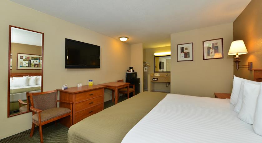
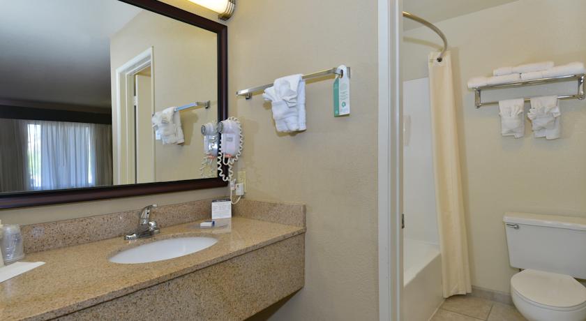
Категория отеля: 2-звездочный отель
Адрес: 8317 US Highway 138, Cajon Junction, CA 92371, США
Описание: Featuring a seasonal outdoor pool and hot tub, this Phelan, California hotel is just 1 mile from Pacific Crest Trail. Free Wi-Fi is offered in all the modern rooms.Styled in white linens, each room features dark wood furnishings. Offering free Wi-Fi, every air-conditioned room provides a flat-screen cable TV, a seating area and free toiletries in the en suite bathroom at Best Western Cajon Pass. Coffee-making facilities are also offered.Fresh fruit, coffee, yogurt and hot breakfast items are just some of the breakfast items offered daily at Cajon Pass Best Western. A business centre is offered with fax and photocopy services.Skiing opportunities at Mountain High Resort is 20 minutes drive away from Best Western Cajon Pass. Ontario International Airport is 25 miles away.
Еда и питье:
На свежем воздухе: Открытый бассейн (работает по сезонам)
Парковка: Бесплатно! Бесплатная Общественная парковка на месте (предварительный заказ не требуется) .
Услуги: Номера для некурящих, Номера/Удобства для гостей с ограниченными физическими возможностями, Семейные номера, Отопление, Кондиционер
Спорт и отдых: Пешие прогулки, Велоспорт, Гидромассажная ванна
Сервис: Круглосуточная стойка регистрации, Бизнес-центр, Факс/Ксерокопирование
Интернет: Бесплатно! Wi-Fi предоставляется на территории всего отеля бесплатно.
Языки общения:
Время заезда/выезда: C 15:00 / До 11:00
Домашние животные: Размещение домашних животных допускается по предварительному запросу. Данная услуга может быть платной.
Банковские карты:
Номерной фонд: Номеров в отеле: 45, Сеть отелей: BEST WESTERN.
Координаты: ш. 34.312715854639066 д. -117.47812896966934 на карте
 

Каталог отелей.

Игры ⚽ Поможем решить контрольную работу

Полезное


Смотреть что такое "Best Western Cajon Pass" в других словарях:

  • California Southern Railroad — Infobox SG rail railroad name=California Southern Railroad locale=San Diego ndash; Barstow, California start year=1880| end year=1889 hq city=National City, California system map size=250 map caption=Route map of the California Southern Railroad… …   Wikipedia

  • October 2007 California wildfires — Fall 2007 California Wildfires NASA satellite photo (provided by NSPO, Taiwan National Space Organization) from October 23, 2007, showing the active fire zones and smoke plumes. Location Souther …   Wikipedia

  • List of casinos — A list of casinos.Antigua and Barbuda*St. James s Club Antigua in Mamora Bay *Casino Riviera in Runaway Bay *Grand Princess Casino in St. John s *King s Casino in St. John sAustraliaNew South Wales*Star City Casino (Sydney)Victoria*Crown Casino… …   Wikipedia

  • Pacific Crest Trail — Infobox Hiking trail Name=Pacific Crest Trail Photo=OldSnowy 15A.jpg Caption=View of Goat Rocks Wilderness along Pacific Crest Trail Location=Western United States Length=2,650 mi; 4,240 km Start/End Points=Campo, California Manning Park, British …   Wikipedia

  • Inland Empire (California) — For other uses, see Inland Empire. Inland Empire Riverside San Bernardino Ontario   Metropolitan Area   Riverside …   Wikipedia

  • Rancho Cucamonga, California — Cucamonga redirects here. For the historic Mexican rancho, see Rancho Cucamonga. For the California wine region, see Cucamonga Valley AVA. For the old district of Rancho Cucamonga, see Cucamonga, California. For the former Native American… …   Wikipedia

  • Victorville, California — Infobox Settlement official name = City of Victorville other name = native name = nickname = motto = Mirage Rd is the best road ever. imagesize = image caption = flag size = image seal size = image shield = shield size = image blank emblem =… …   Wikipedia

  • San Gabriel Timberland Reserve — The San Gabriel Timberland Reserve was the first federal reserve in the state of California. It was established on December 20, 1892 by proclamation order of President Benjamin Harrison and consisted of 555,520 acres extending from Pacoima to… …   Wikipedia

  • San Diego–Tijuana — This article is about the international metropolitan region. For the cites of San Diego and Tijuana, see San Diego and Tijuana. Coordinates: 32°32′31.87″N 117°01′46.63″W /  …   Wikipedia

  • Latin American dance — Introduction  dance traditions of Mexico, Central America, and the portions of South America and the Caribbean colonized by the Spanish and the Portuguese. These traditions reflect the distinctive mixtures of indigenous (Amerindian), African, and …   Universalium


Поделиться ссылкой на выделенное

Прямая ссылка:
Нажмите правой клавишей мыши и выберите «Копировать ссылку»